Land use is commonly understood to be a surface designation—with categories and ownership relatively unambigious across a site’s depth. But in one of the most thrilling stratification of land-use in the region, the Rock City complex layers multiple land uses with the same site—recreation, relocation, and record administration. Here, surface and sub-surface are separated into at least two primary uses—capitalizing on a legal instrument known as mineral rights. Long the site of a limestone quarry, stone extraction has been exhausted since mid-century with the vast rooms of the quarry sitting empty or occupied by provisional uses such as mushroom production. In its most recent inhabitation, the subterranean quarry is now a vast cold-storage facility, with the Salt Lick Point trail occupying the surface.
As part of the land acquisition for the town of New Valmeyer following relocation after the flood of 1993, the city was required to also purchase the 6,000,000 SF subterranean limestone quarry. Mined using the ‘pillar and room’ method, the quarries were seen by many in the community as an obstacle to development; but at least one regional resident saw in the vast underground spaces an opportunity. Owner Joe Kopeis has developed over half of the caverns as the Gateway Cold Storage facility—which counts as its tenants Little Caesars Pizza, Breyers Ice Cream, and the National Archives and Record Administration (NARA).
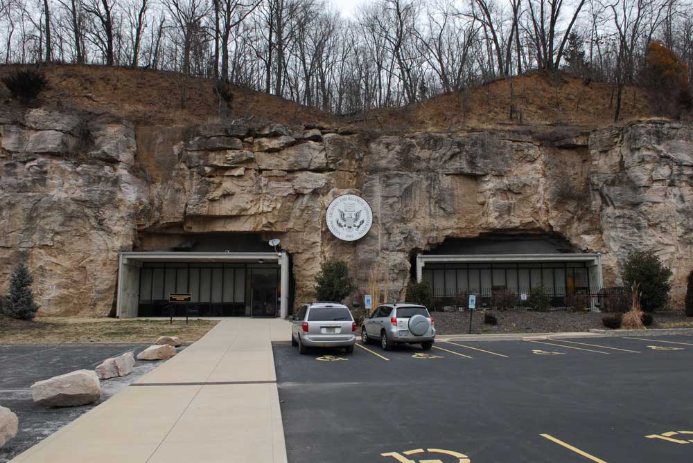
The NARA facility, with its prefabricated concrete entryways and eagle seal incongruously merged with the limestone bluff face, is dedicated to the storage of 2 million cubic feet of Civilian Personnel Records. Nestled in the voids of the quarry is a 400,000 square food building that houses most personnel records produced since 1973. The facility opened in 2009 after a fire at their St. Louis County facility, and currently works in conjunction with the NARA Dunn Road Building, where another 2.3 million cubic feet of records are stored.
Sitting atop the cave-like quarry is the Salt Lick Point trail, so-named after a major manufactory of salt that was operated here as early as 1802. The trail is part of a distributed system of public access points that the Illinois DNR have made available along the woody talus edges of the bluff. Here, you can get experience the upland forests that still define this seam and that give the American Bottom its rich fall colors.